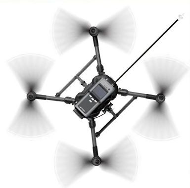
Solafact 9401
Solafact 9401
Time-to-Count nuclear Detection technology
Solafact 9401 is a nuclear reconnaissance UAV. The flight platform is DJI’s industry-grade industrial UAV, and the payload adopts the world’s advanced time-of-flight ion mobility spectrometry technology, array multi-sensor fusion technology and Time-to-Count nuclear detection technology can detect trace chemical poisons, industrial toxic and harmful gases and radioactive pollution online, quickly and accurately.
Technical Indicators
| Parameter Name | Performance parameters |
| Measurement and control distance | >= 5km |
| Maximum flight time | >= 30 minutes |
| Maximum flight altitude | 5km |
| Maximum flight speed | 21 meters/second |
| Maximum rising speed | 6 meters/second |
| Working temperature | – 20 deg * C to 40 deg * C |
Nuclear detection indicators: |
|
| Detection range | 1uSv / h – 10mSv / h |
| Detection accuracy | (plus/minus 10)% |
| Energy response | (plus/minus 10)% |
| Detection source type | 35KeV-1.5MeV |
| Detector technology type | GM counting tube m/s |
Chemical detection indicators: |
|
| Chemical detection indicators: | 0.2mg / (m ^ 3) |
| Viex | 0.5mg / (m ^ 3) |
| Mustard gas | 2mg / (m ^ 3) |
| Hydrocyanic acid | 10mg / (m ^ 3) |
| Phosgene | 10mg / (m ^ 3) |
| Ammonia | 20mg / (m ^ 3) |
| sulfur dioxide | 10mg / (m ^ 3) |
| hydrogen sulfide | 10mg / (m ^ 3) |
Application Area
The drone can also find and locate the source of the leak, and then use the airborne gimbal to map the area to facilitate emergency personnel to quickly arrive at the scene.
Features
Nuclear reconnaissance detection results can be displayed in real time on the drone control terminal through transparent transmission. Professional visual analysis software can be seamlessly connected with nuclear reconnaissance drones to achieve second-level response and map nuclear and chemical pollution areas in real time , the three-dimensional pollution concentration distribution is clear at a glance, and the pollution source can be quickly identified.
High-end: Integrating world-class nuclear reconnaissance equipment and industry-leading drone platforms.
Unmanned: Operation beyond visual range, reconnaissance of nuclear radiation and chemical hazards in dangerous areas from a safe distance.
Intelligent six-way positioning and obstacle avoidance, one-click return; qualitative and quantitative detection of pollutants, combined with neural network algorithms to form a pollutant situation awareness map Visualization: Visualization-assisted flight, rapid mapping of surrounding maps, fusion of visual and nuclear pollution conditions Informatization: remote transmission of investigation data, combined with the back-end information decision-making platform, significantly reduces investigation time and quickly formulates hazardous site protection methods and processing methods.


